
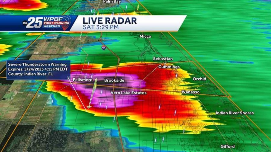
Late on Friday, July 25, 2025, a volatile storm system fueled by sweltering heat and tropical humidity triggered widespread severe thunderstorm watches and warnings across multiple U.S. states. The Storm Prediction Center (SPC) has placed much of the Northeast, parts of the Mid‑Atlantic, and segments of the Central Plains and Upper Midwest on high alert for potentially destructive thunderstorms, featuring damaging winds, hail, and flash flooding.
New England & Northeast under Watch
In Massachusetts and Connecticut, notably including the Boston metro area, a severe thunderstorm watch remained in effect until 9 p.m. EDT. This served as a precursor to expected storms with intense rain, gusty winds, and frequent lightning.
In Connecticut, the combination of persistent heat and tropical humidity pushed the heat index upwards of 105 °F, prompting a simultaneous heat advisory for the region. The storms developed in the humid air mass and moved slowly southeastward, earning the attention of meteorologists for their potential to produce damaging winds.
Storm Impacts: Connecticut in Focus
By mid‑afternoon, severe storms delivered measurable impacts across Connecticut. In Waterbury, a tree was blown into a house, causing structural damage. Meanwhile, in Lisbon, a lightning strike sparked a fire in the attic that rendered the home temporarily uninhabitable—even though no one was injured.
Numerous roads were blocked by fallen trees and downed power lines; Route 341 in Kent and Route 167 in Avon were closed amid hazardous conditions. Emergency responders also addressed several weather-related vehicle accidents, including a rollover incident in Salisbury and a collision on Route 8 near Naugatuck.
Statewide, Eversource reported up to 4,965 power outages at the storm’s worst, with Waterbury alone accounting for about 900. By 7:30 p.m. outages dropped to 2,340, though many remained in Waterbury, North Stonington, and Sharon. United Illuminating reported minimal disruptions, affecting only three customers in Hamden, West Haven, and Shelton.
Broader Outlook: Multiple States on Alert
Beyond Connecticut, SPC and NOAA reports have spotlighted severe thunderstorm risk across New England, the Mid‑Atlantic, and into parts of the Central U.S. and Midwest, where severe thunderstorms and heavy rain are expected to persist through the weekend.
Reports from Newsweek confirm that residents in at least five states—including Virginia, Ohio, Indiana, North Carolina, and Pennsylvania—were urged to seek immediate shelter during Wednesday’s storm bouts, as winds approached 60 mph with threats of flying debris and falling trees.
Weather Setup: Heat, Humidity & a Cold Front
Meteorologists have attributed the conditions to two concurrent factors:
· Heat and humidity dome: In areas like Connecticut, heat indices reached 100–105 °F, creating a highly unstable airmass ripe for thunderstorm development.
· An approaching cold front: This boundary is pushing southward, acting as a trigger for storms over the region, and expected to bring relief once it passes overnight.
This confluence of conditions has been echoed by national weather services, which warn of continued threat from strong to isolated severe thunderstorms, heavy rain, flash flooding, and possible hail—from the central Plains across the Upper Midwest and into the Mid‑Atlantic through the weekend.
Safety Tips & Recommendations
- During a watch: Conditions are favorable—stay alert and be ready to move indoors.
- During a warning: Severe weather is imminent or occurring. Take shelter immediately in a sturdy building, preferably in an interior room or basement away from windows.
- Avoid driving during storms, especially near downed trees or power lines. If caught on the road, park safely away from hazards and avoid flooded stretches.
- Have emergency supplies ready—flashlight, battery-powered radio, water, and non-perishable food—since power loss is common during such storms.
- Pay attention to official sources, including NOAA Weather Radio, local news outlets, and well-respected weather apps.
What Happens Next?
Once the cold front swings through Friday night into Saturday, heat and humidity are projected to decrease. Saturday will likely feature more comfortable conditions, with lower humidity and sunny skies across much of the Northeast. Still, Sunday is expected to bring humidity back and a chance for scattered afternoon storms—even if storm intensity lessens toward the evening.
Over the weekend and into early next week, the central Plains, Upper Midwest, and Mid‑Atlantic remain under threat of additional storms. The SPC has highlighted potential for damaging winds, hail, and flash flooding, though the most severe risk appears centered north of the Gulf states at this time.






















Responses (0)
Sign in to share your thoughts.
Sign in